Missouri Trailblazing
Your Guide to Missouri's Horse Trails and Camping
Orleans/Rutledge Trail
Stockton Lake
U.S. Army Corps of Engineers
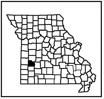
Location:
Cedar County
News, Updates, & Warnings:
Originally known as Orleans trail, but now known as Rutledge Bluff Overlook Trail.
Open during hunting seasons so, please use caution.
Directions:
From Nevada MO, take Hwy 54 east to Hwy 39, turn south. Follow Hwy 39 to Hwy RB in Stockton. Turn east and drive several feet to South Blake Road, the first road to the right. Turn and continue to the dead end, turn right again and follow to camp.
Miles of Trails:
18 mile linear, 36 out and back.
Equestrian Camping:
Yes, there are 5 primitive campsites.
Trail Notes:
The trail is rocky, steep, and has bluffs to ride along. You have to negotiate downfall, creeks, gravel roads, and cross Hwy 215. There are several shortcut trails you can ride when the water level in the lake is low.
Other Trail Users:
Hikers, mountain bike riders, and hunters.
Volunteers Helping With This Page:
No one at this time, available to adopt. If interested, please contact us.
